Home / Gyeongsang / Soeulbipo Fortress
Goseong, South Gyeongsang: a free Joseon sea fortress with a harbor view
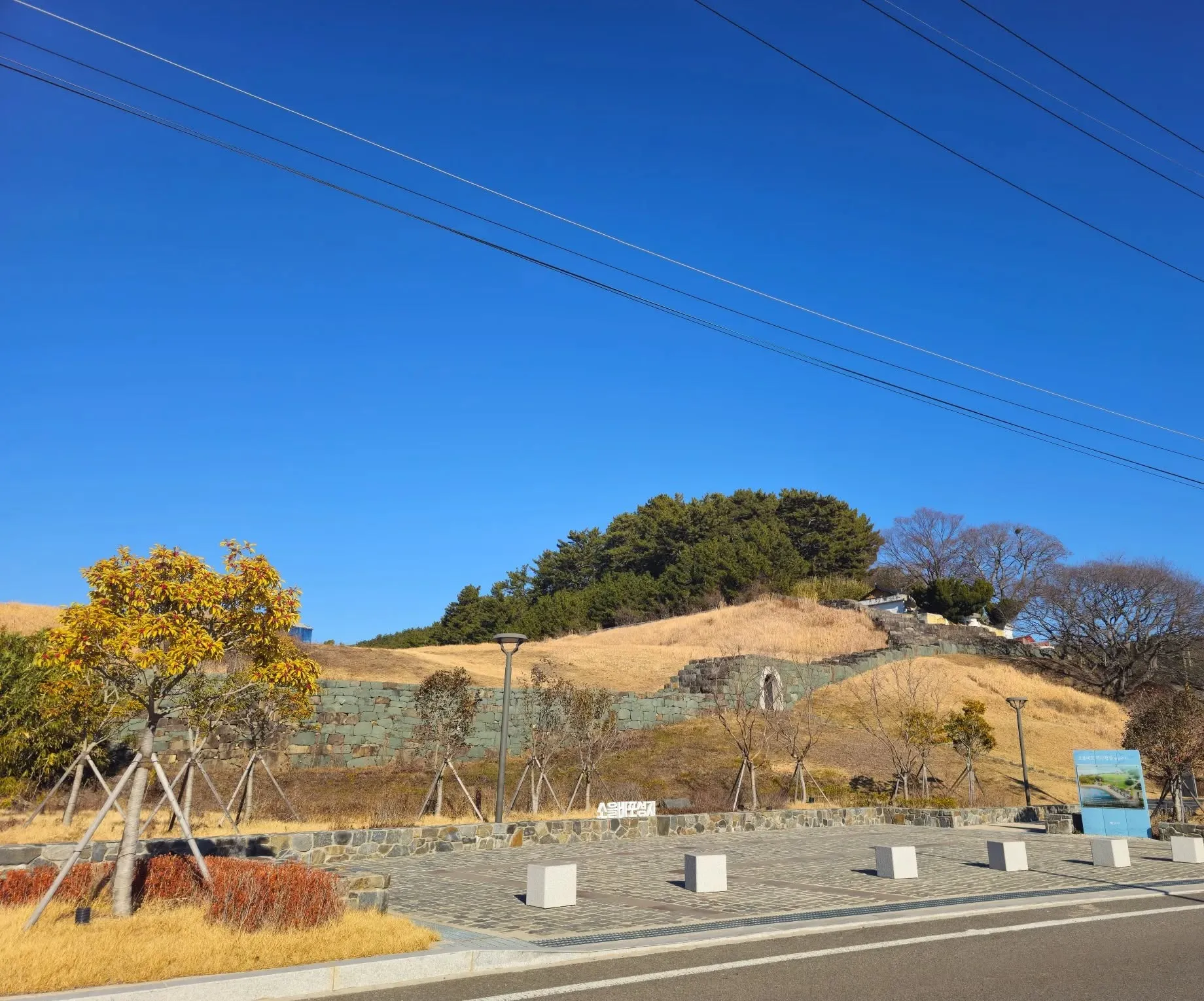
Soeulbipo Fortress in Goseong (South Gyeongsang, not Gangwon): stone walls of a 15th-century Joseon naval base on a low hill above a small harbor. Free, open at all times, and I had it to myself when I went.
- Getting there
- In Donghwa-ri, Hail-myeon, on the south coast of Goseong County, South Gyeongsang. I drove; there's a car park. I couldn't confirm bus connections.
- Cost
- Free (my visit, January 2026; Korea Tourism Organization).
- Time needed
- 30 minutes to 1 hour (estimate)
- Best time
- Open at all times, every day (Korea Tourism Organization).
Tap any Korean name on this page to hear it. Prefer Naver Map? In the app (set to English), search Soeulbipo Fortress Goseong, or paste the Korean name:소을비포성지
Short version: On a low hill above a small harbor in Goseong County, South Gyeongsang (not the Goseong in Gangwon), the stone walls of a 15th-century Joseon naval fortress have been restored. You can walk along them and climb to the top for a wide view of the sea. It’s free, open at all times, and there’s a car park. When I went, there was nobody there but me. If you’ve come to Goseong, it’s worth stopping by once.
Last checked: 2 November 2026. The history comes from the board at the site (photographed January 2026), the Korea Tourism Organization (KTO) and the Encyclopedia of Korean Culture. Opening times and admission come from the KTO listing (updated March 2026). What it was like is from my own visit. Tell me if anything has changed.
What it is
Soeulbipo was a coastal military base of the Joseon dynasty, set up to defend the south coast against Japanese pirates (KTO; Encyclopedia of Korean Culture). The KTO describes the fort as a wall built along the slope of a low hill that juts out to the sea, with its front facing the water.
The board at the site, headed Goseong Soeulbipo Jinseong (a South Gyeongsang Provincial Monument, designated in 1994 according to the Encyclopedia of Korean Culture), says the fortress was built in 1491 as a small naval post. It says the post, used for gathering troops, was moved to Geoje in 1604 and brought back here in 1606. The board and the Encyclopedia of Korean Culture both give the wall a circumference of about 330 m. Excavations in 1998 and 2005 investigated the wall, the north and east gates and building sites inside; the wall and gate towers were then restored (Encyclopedia of Korean Culture).
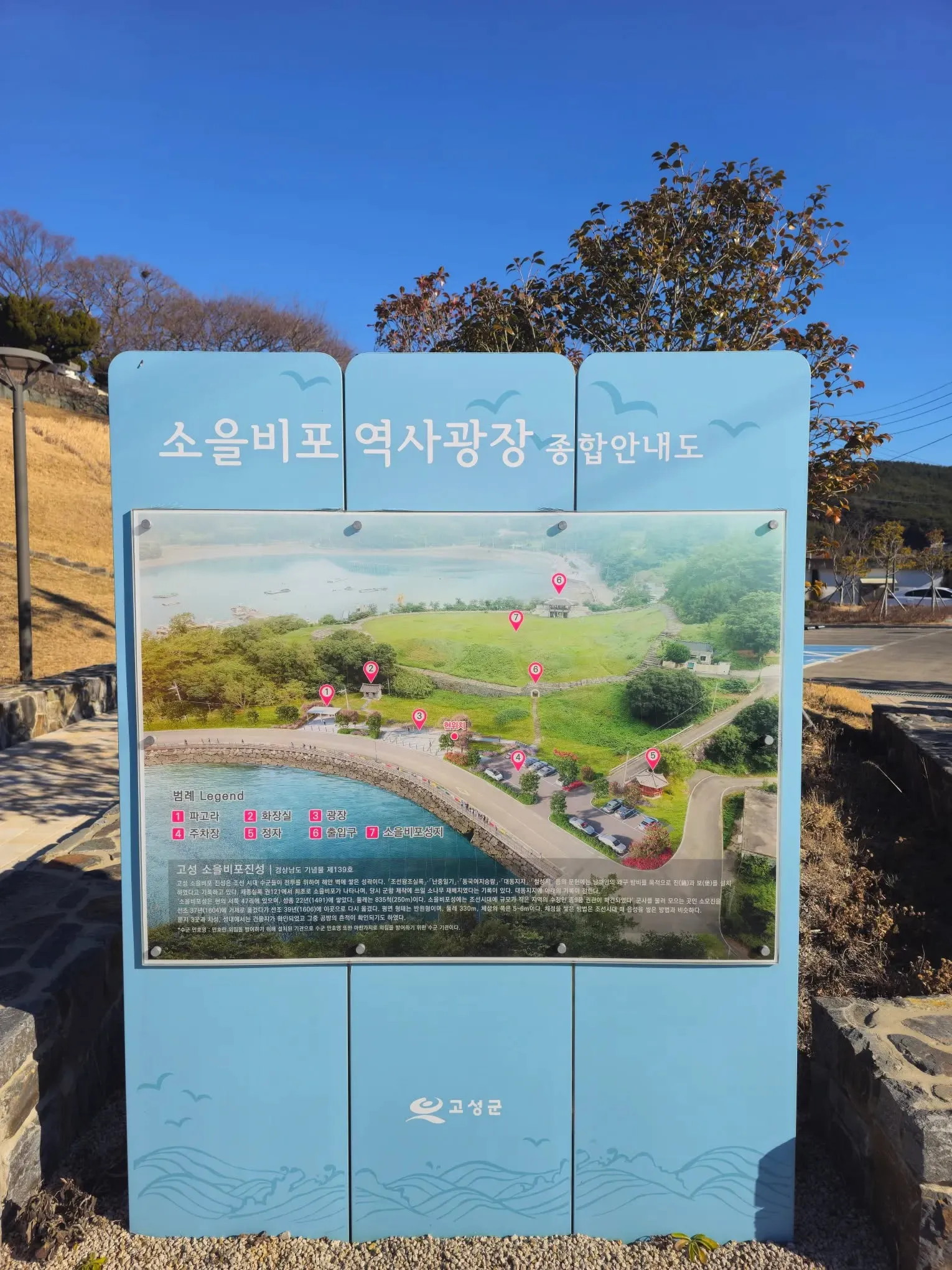 The site board (Korean only), with an aerial view of the fortress above the harbor.
The Imjin War
I was told volunteer militias held off the Japanese here during the Imjin War, but I couldn’t confirm that from official sources. What the KTO says is that during the Imjin War the Goseong county office was moved for a time to Jarando and Garyongpo, near this fortress, and the fortress is said to have been regarded as militarily very important.
What you’ll see
A paved plaza at the foot of the hill, a white name sign, and the restored stone walls climbing the hill with an arched gate. As I wrote, it’s easy to walk, like a stroll, and the surroundings are well kept. From the wall you look down over the harbor to the sea and the hills beyond.
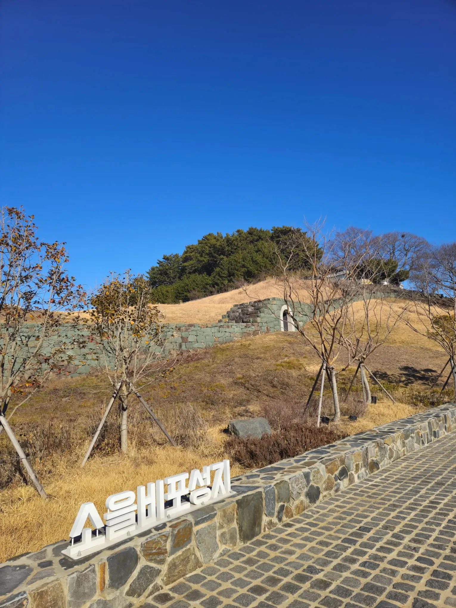 The name sign at the foot of the fortress.
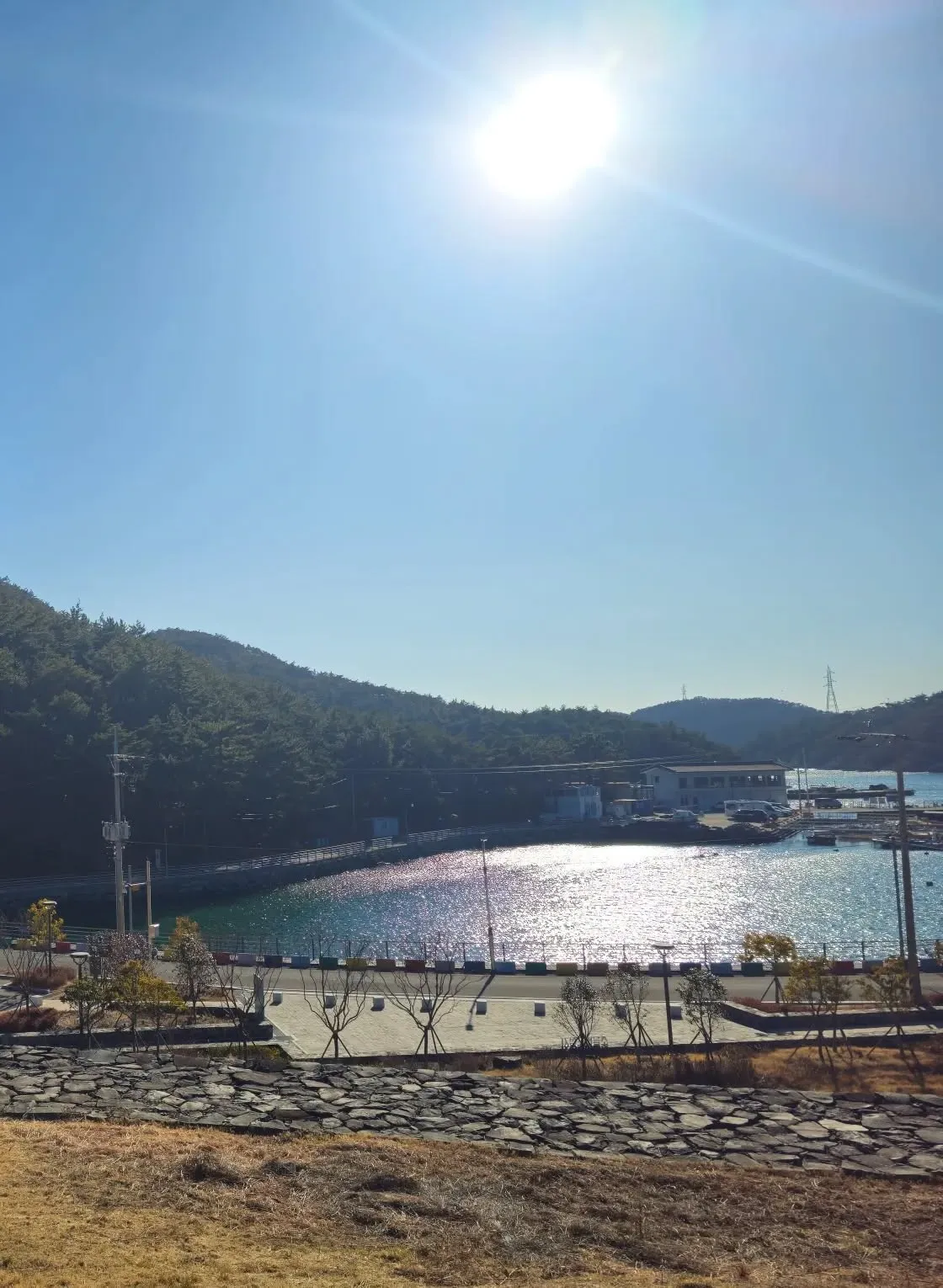 The view from the wall, over the harbor.
Visiting
| Soeulbipo Fortress | |
|---|---|
| Hours | Open at all times, every day of the year (KTO) |
| Admission | Free (my visit; KTO) |
| Parking | Available (my visit; KTO) |
| Address | Donghwa-ri, Hail-myeon, Goseong-gun (KTO lists lot 398-4) |
- Which Goseong? This one is in South Gyeongsang, on the south coast, not the Goseong in Gangwon Province. Check before you set off.
- Facilities: the site map marks a car park, toilets, a plaza, a pergola and a pavilion at the foot of the fortress.
- Signs: the site board is in Korean only.
- Crowds: when I went, on a Thursday in January, there was nobody there but me.
How to get there
By car: the fortress is in Donghwa-ri, Hail-myeon, Goseong County, South Gyeongsang. Search the Korean name, 소을비포성지, in Naver Map and check it’s in Hail-myeon. There’s a car park.
By public transport: I couldn’t confirm bus connections, so I haven’t listed any. Check the live route in Naver Map before you go.
How to check buses in English: install Naver Map and switch it to English in its settings. When we checked it in October 2026, the English version showed bus routes, stop names and live arrival times in English. Google Maps also gives public transport directions in Korea, but as of late September 2026 it still had no turn-by-turn walking or driving navigation here. Stuck? Call the Korea Travel Hotline: dial 02-1330 from a Korean mobile phone (+82-2-1330 from abroad). It has English-speaking staff.
Tips
- Climb to the top. As I wrote, the sea view alone is worth the climb.
- Take your time. There were hardly any tourists, so it’s good for some time to yourself.
Who it’s for
Likely to suit (estimate): anyone interested in Korean history and old fortresses, road-trippers on the South Gyeongsang coast, and travelers who like quiet places with a sea view.
Sources
Checked against the board at the site (photographed January 2026: the name, South Gyeongsang Provincial Monument, built in 1491, a small naval post, the troop-gathering post’s move to Geoje in 1604 and back in 1606, about 330 m around; the site map’s car park, toilets, plaza, pergola and pavilion), the Korea Tourism Organization listing (updated March 2026: set up against Japanese pirates, the wall on a hill facing the sea, the Imjin War county office at Jarando and Garyongpo, the address, open at all times, every day, free, parking) and the Encyclopedia of Korean Culture (built in 1491, 330 m around, designated in 1994, the investigations in 1998 and 2005 and the restoration). Free entry, parking and my impressions are from my own visit.