Home / Incheon / Sindo, Sido & Modo
Sindo, Sido and Modo: how to get there now the bridge is open
The ferry is no longer the way in. Since July 2026 a free 24-hour bridge links Yeongjong Island to Sindo, Sido and Modo. Updated bus, cycling and driving directions, plus what to see on Modo.
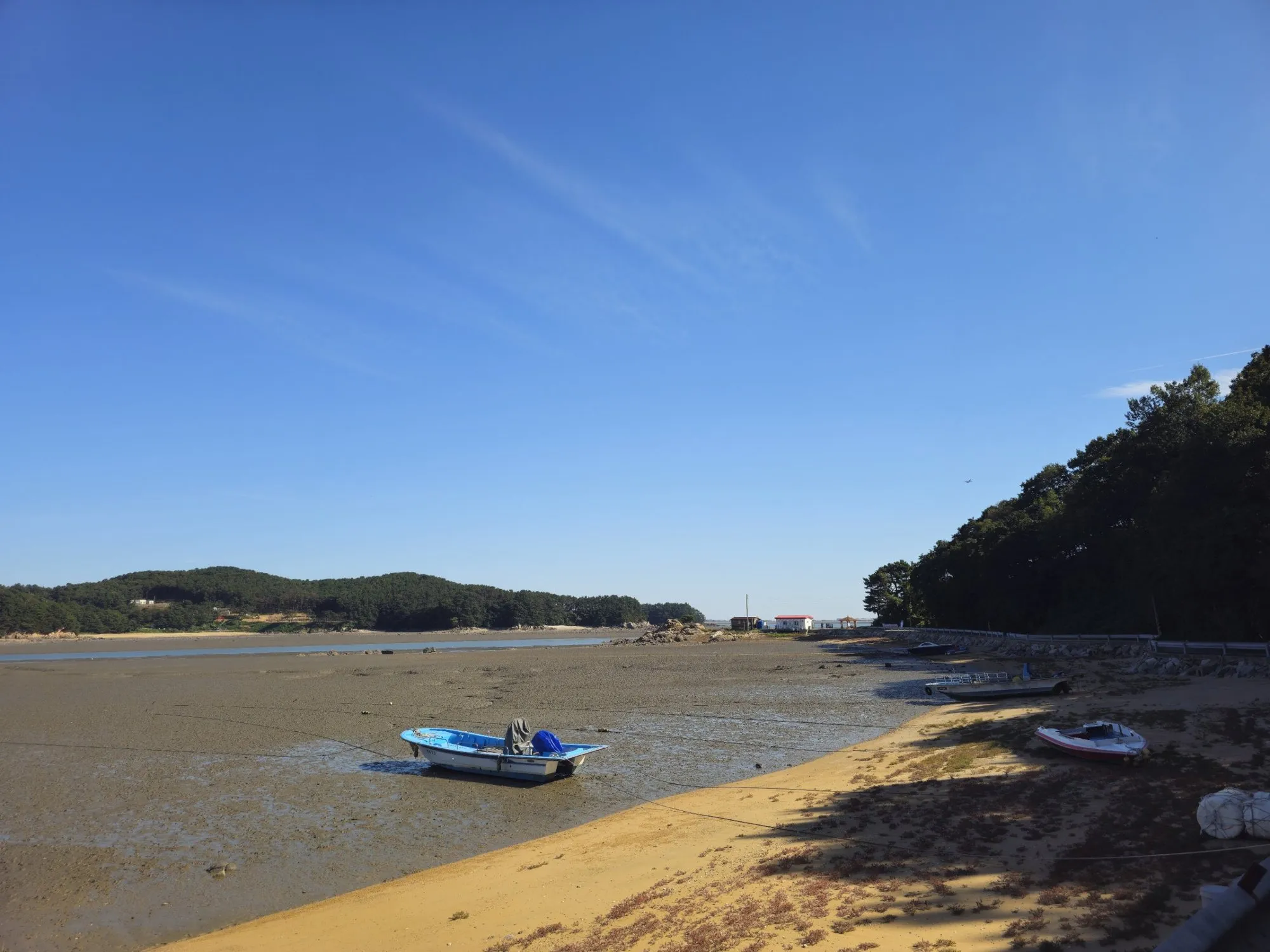
- Getting there
- AREX to Unseo Station, then bus 2251 to Sindo. Or drive, cycle or walk over the Sindo Peace Bridge.
- Cost
- Bridge free. Baemikkumi Sculpture Park ₩2,000, cash.
- Time needed
- Half a day for all three islands (estimate)
- Best time
- Low tide for the mudflats. Expect company even on weekdays.
Tap any Korean name on this page to hear it. Prefer Naver Map? In the app (set to English), search Modo, or paste the Korean name:인천 옹진군 모도
Short version: if a guide tells you to catch a ferry from Sammok Wharf to reach Sindo, Sido and Modo, it’s out of date. On 14 July 2026 the Sindo Peace Bridge (신도평화대교) opened between Yeongjong Island (where Incheon Airport is) and Sindo, and since August 2026 the ferry no longer stops at Sindo. You can now drive, cycle or walk across at any hour, for free, and a city bus runs from early morning to late evening.
Last checked: 5 October 2026. Bus timetables on the islands were still settling after the bridge opened. Check the live bus before you go (see “How to check buses in English” below), and tell me if anything here has changed.
What changed
For decades the only way onto these three small islands off Yeongjong was a short car ferry from Sammok Wharf. Sindo, Sido and Modo were already linked to each other by small bridges, but reaching any of them meant planning your day around the ferry.
The new bridge changes that:
| Sindo Peace Bridge | |
|---|---|
| Length | 3.26 km (2.07 km over the sea) |
| Lanes | Two-lane road with a shared footpath and bike lane |
| Who can use it | Cars, motorbikes, bicycles and pedestrians |
| Toll | Free |
| Hours | Open 24 hours |
| Speed limit | 50 km/h on the bridge |
The bridge is the first stage of a planned road that would eventually continue from Sindo to Ganghwa Island. That second stage isn’t built yet, so for now Sindo is the end of the line.
How to get there
By bus (no car)
City bus 2251 started running on 19 September 2026. It links Yeongjong Island to Sindo over the new bridge, and the stop that matters for most visitors is Unseo Station (운서역) on the AREX Airport Railroad line.
- From Seoul: take AREX toward Incheon Airport and get off at Unseo Station, then catch bus 2251 toward Sindo.
- Where it ends: the route terminates on Sindo, near the old ferry landing. It does not continue to Sido or Modo.
- How often: roughly every 60 to 90 minutes, with a single bus covering the route (about 14 trips a day). The first departure from the depot is around 05:00 and the last around 23:30.
- Getting to Sido and Modo: the 2251 stops on Sindo. Over the summer a temporary shuttle ran from Modo straight to Unseo Station, but it was due to end once 2251 started, and I couldn’t find a current bus between Sindo and Modo. Plan to walk or cycle. The three islands are compact; the main road looping all three is about 16 km.
With buses this infrequent, check the live arrival time before you get to Unseo Station rather than turning up and waiting.
How to check buses in English: install Naver Map and switch it to English (open the menu ☰, tap the settings gear, then Language → English; the layout varies a little between app versions). It shows routes and live bus arrival times in English. Google Maps also gives public transport directions in Korea, but as of October 2026 it still has no turn-by-turn walking or driving navigation here. Stuck? Call the Korea Travel Hotline on 1330 from any Korean phone, no area code needed (+82-2-1330 from abroad). It has English-speaking staff and runs every day of the year.
By car
Head for Yeongjong Island and follow signs for Sindo (신도) or the Sindo Peace Bridge (신도평화대교). The bridge starts on the north side of Yeongjong, near Sammok Wharf (which still runs ferries to Jangbongdo, just not to Sindo).
Two warnings:
- Expect jams at weekends and on public holidays. On the first holiday after the bridge opened (17 July 2026), incoming cars were stopped from crossing for more than four hours because traffic on the islands had ground to a halt, and local press was still reporting heavy congestion a month later. The road leading onto the bridge on the Yeongjong side is a single lane. Weekdays are calmer than that, but when I drove over on a Thursday in October it was still fairly busy. Go early, or leave the car behind.
- Parking is limited. As of August 2026, Modo had a public car park of a little over 100 spaces, and a larger one (about 250 spaces) by Sugi Beach on Sido was still under construction. Island roads are narrow; don’t park on the verge.
By bike
The bridge has a shared path for bikes and pedestrians, so you can ride from Yeongjong straight onto the islands. Two things to know:
- AREX doesn’t take full-size bikes any more. Since the Third Incheon Bridge opened on 5 January 2026, AREX has banned regular (non-folding) bicycles at all times, and the old weekend reservation scheme has gone. Bring a folding bike, or ride onto Yeongjong over the Third Incheon Bridge (Cheongna Haneul Bridge) itself, which has separate, barrier-protected bike and pedestrian paths alongside the car lanes.
- Wind. It’s an open sea crossing. On a windy day the bridge is hard work and uncomfortable next to traffic.
Before the bridge, bike rental shops clustered around the Sindo ferry landing. I haven’t been able to confirm which are still operating now that ferry passengers no longer arrive there, so don’t plan your day around renting one.
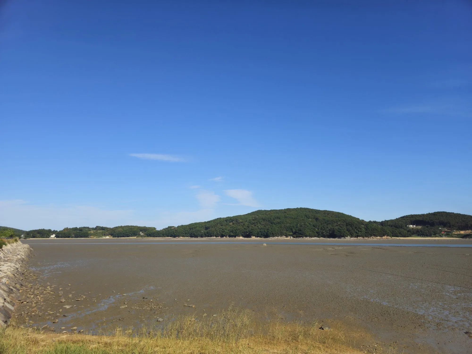 Low tide on Modo: the sea pulls back a long way, leaving mudflats right up to the island hills.
What to see
Modo (모도)
The smallest of the three islands, and where I finished my day. At low tide the water drains out of the channels and leaves wide grey mudflats, small fishing boats sitting on the mud, and long views back toward Sido. The village’s own guide singles out Baemikkumi Beach, on the southwest corner, for its sunsets.
Baemikkumi Sculpture Park (배미꾸미 조각공원) is on Modo’s southwest tip, at the beach of the same name. It’s a private outdoor gallery of works by the sculptor Lee Il-ho, set right on the shore. Practical notes:
- Entry: ₩2,000 per person. Bring cash.
- Heads-up for families: many of the sculptures are openly erotic. It’s art, but it’s not subtle.
- There’s a café on the site.
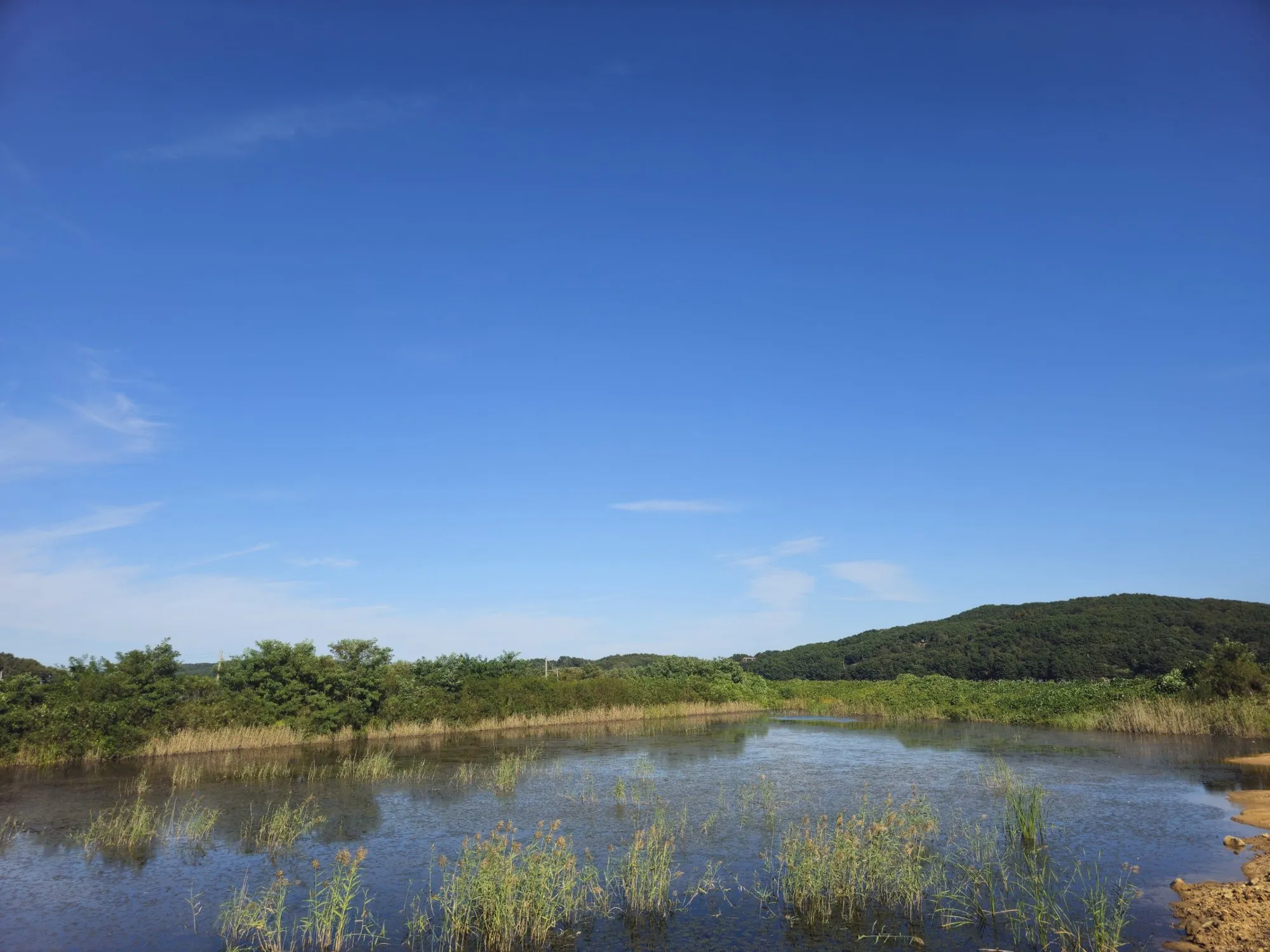 Inland from the shore, Modo is reed ponds, small fields and quiet roads.
Sido (시도)
The middle island. Its best-known spot is Sugi Beach (수기해변), where the 2004 K-drama Full House built its outdoor set.
Sindo (신도)
The largest island and where the bridge and bus arrive. Gubongsan (구봉산), 179 m high, has an easy forest trail with views over the mudflats and toward the airport.
Tips
- Check the tide. The islands look completely different at high and low tide. If you want mudflats and boats on the mud, go at low tide; Korea’s national tide service (바다누리, KHOA) publishes free tide tables.
- Bring water and a hat. There’s very little shade on the bridge or along the shore roads.
Who it’s for
Anyone after an easy island day from Seoul or Incheon, a day on the bike, or something to fill a long layover: Unseo Station is two stops from Incheon Airport Terminal 1 on AREX.
Sources
Checked against Incheon city and Yeongjong district announcements and Korean news reports on the bridge opening (July 2026) and the launch of bus 2251 (September 2026). For live bus times, use Naver Map in English (see above).